
| the science | |
| tools & techniques | |
| marianas history | |
| daily journal | |
| the team | |
| questions & answers | |
|
the islands Saipan Anatahan Sarigan Guguan Alamagan Pagan Agrigan Asuncion Maug Uracas |
|
|||||||||||||||||||||||||||||||||||||||||||||||||||||||||||||||

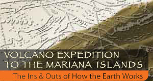
Introduction

 The Earth we stand on seems at times to be a solid and immovable mass, but in fact its continents and seafloors are in
constant motion. Earth's crust rides on tectonic plates that bump into each other like blocks of ice crowded into a small pond.
The Earth we stand on seems at times to be a solid and immovable mass, but in fact its continents and seafloors are in
constant motion. Earth's crust rides on tectonic plates that bump into each other like blocks of ice crowded into a small pond.
Those collisions are constant. They occasionally remind us of their awesome magnitude through volcanic eruptions and earthquakes. The Pacific Ocean is home to some of the most intense tectonic activity in the world, especially along its fringes in the region appropriately named the Ring of Fire.
The Pacific tectonic plate is one of the world's oldest sections of oceanic crust. On the Ring's western edge, it disappears underneath the Philippine plate sometimes at such sharp angles that it is almost going straight down. The subduction zone there creates the deepest point on Earth's surface, the 7-mile-deep Marianas Trench.
That collision of plates also breathes fire into a volcanic island chain known as IBM, short for Izu-Bonin-Mariana. The chain begins in the south in islands that comprise a United States commonwealth and extends northward into the heart of Japan. Scientists have chosen the 1,500-mile-long chain as one of two places in the world to study some of the most challenging questions in plate tectonics.
A research team that includes David Hilton of Scripps Institution of Oceanography, Erik Hauri of the Carnegie Institution of Washington and Tobias Fischer of the University of New Mexico will traverse nine islands in the Mariana chain in search of answers starting in April. The scientists will use clues left behind by millions of years of activity in the tephra (objects ejected by volcanoes) that covers the islands, in the gases spewing from volcanic craters and the geothermal fluids found in mudpots and bubbling hot springs.
Along the way, they'll encounter the footprint of the islands' human inhabitants, from the present-day residents of the Commonwealth of the Northern Mariana Islands to the vestiges of war commemorated in the wreckage of World War II fighter planes and the airstrips from which history-making sorties originated.
At the end of the island-hopping journey, scientists could have a better understanding of the features that make Earth habitable. The rocks they'll hold in their hands contain a record of how landmasses have developed and disappeared. The journey of the gases they sample from deep Earth to the surface will give clues about the creation of Earth's atmosphere and the conditions that make life possible. Enter and join a journey into the depths of Earth and back out again.