Scripps Institution of Oceanography, UCSD
Volcano Expedition to the Marianas

the expedition
the science
tools & techniques
marianas history
daily journal
the team
questions & answers

Cal

the islands
Saipan
Anatahan
Sarigan
Guguan
Alamagan
Pagan
Agrigan
Asuncion
Maug
Uracas
April 2004
S M T W T F S
        1 2 3
4 5 6 7 8 9 10
11 12 13 14 15 16 17
18 19 20 21 22 23 24
25 26 27 28 29 30  
             
Link to Map

Funded by:

Daily Journal


Day 9 | April 17, 2004
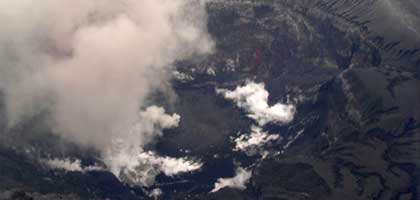
Anatahan

Anatahan crater with lava dome

Anatahan crater with lava dome

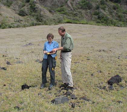
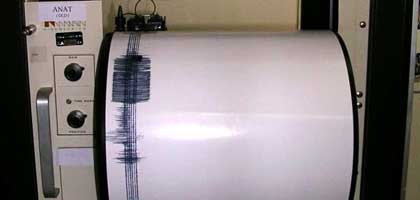
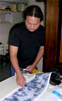
Ray Chong pointing at seismic events
Since its first historical eruption in May 2003, Anatahan has remained active. In the past few weeks, the seismic station on the island recorded as many as 3000 earthquakes per day. Both the US Geological Survey and the Emergency Management Office (EMO) are monitoring the volcano closely. Because Anatahan is a major target of our expedition, we did a helicopter over-flight to make more observations. When we climbed over the rim into the active crater, we noticed right away that there was much more gas coming from the crater then we had observed during our initial flyover just days ago. You can see a lot of white steam and, if you look closely, a steaming lake on the left. In the center of the photo, a small explosion is apparent, similar to the one we saw on the flyover. Today's explosion, however, was more energetic, releasing more gas [movie]. The seismic events that are associated with these small explosions were recorded by EMO, and seismic technician Ray Chong is pointing out the events that occurred during the time of our helicopter over-flight.

Seismograph at EMO

Seismograph at EMO

Introduction Video

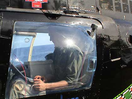
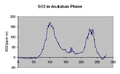
One of the goals of our expedition is to measure the gas emissions from the volcanoes using the mini-DOAS. We mounted the mini-DOAS on the helicopter, pointing the telescope vertically out of the window. You can see the red fiber optics cable that leads from the telescope to the instrument. Toby is using a computer to record the data during the flight. We traversed under the volcanic plume and successfully made measurements of the SO2 emissions from the volcano. The graph below shows the increase in SO2 content as we flew under the plume. We did several traverses and we will use this data to calculate the flux of SO2 from the volcano and compare it with the amount we measured in May 2003, only ten days after the eruption. On our way back to Saipan, we briefly landed at a safe location on the eastern side of the island, refueled, checked our notes and returned to Saipan.

Mini-DOAS mounted in the helicopter

Mini-DOAS mounted in the helicopter

Sulfur dioxide content of the Anatahan plume

Sulfur dioxide content of the Anatahan plume. Two transects are show

Alison and Toby checking notes on the E-meadow

Alison and Toby checking notes on the E-meadow