
| the expedition | |
| the science | |
| tools & techniques | |
| marianas history | |
| daily journal | |
| the team | |
| questions & answers | |
|
the islands Saipan Anatahan Sarigan Guguan Alamagan Pagan Agrigan Asuncion Maug Uracas |
|
|||||||||||||||||||||||||||||||||||||||||||||||||||||||||||||||

Daily Journal
Day 11 | April 19, 2004
Agrigan
Maarten's log
 After boarding the R/V Wecoma yesterday evening, we cruised overnight for 50 miles from Pagan to Agrigan. We landed at Agrigan
with mail and supplies for the inhabitants, who helped bring our equipment and jet fuel ashore. The group with the helicopter flew in from Pagan
this morning and refueled before attempting to fly to the summit. Agrigan is the tallest of the Mariana volcanoes, and clouds consequently obscure
the peak for most of the time. Today was no different and poor visibility above 500ft prevented us from landing in the summit caldera.
After boarding the R/V Wecoma yesterday evening, we cruised overnight for 50 miles from Pagan to Agrigan. We landed at Agrigan
with mail and supplies for the inhabitants, who helped bring our equipment and jet fuel ashore. The group with the helicopter flew in from Pagan
this morning and refueled before attempting to fly to the summit. Agrigan is the tallest of the Mariana volcanoes, and clouds consequently obscure
the peak for most of the time. Today was no different and poor visibility above 500ft prevented us from landing in the summit caldera.
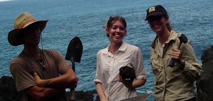
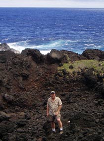
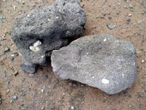 We made the most of our short time on Agrigan and
sampled lavas, pyroclastic deposits and scoria along the coast. Some
of the lavas had plagioclase "megacrysts" and xenoliths in them that were entrained in the magma as it rose through the lower crust.
We made the most of our short time on Agrigan and
sampled lavas, pyroclastic deposits and scoria along the coast. Some
of the lavas had plagioclase "megacrysts" and xenoliths in them that were entrained in the magma as it rose through the lower crust.
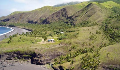
 Agrigan
is full of life, with thick banana and coconut groves, heavily vegetated slopes
and friendly people. Flies also thrive on the island and are
quite a nuisance. A word of advice for if you ever visit Agrigan: Don't inhale
too deeply, or you might suck in a fly! I did.
Agrigan
is full of life, with thick banana and coconut groves, heavily vegetated slopes
and friendly people. Flies also thrive on the island and are
quite a nuisance. A word of advice for if you ever visit Agrigan: Don't inhale
too deeply, or you might suck in a fly! I did.