| the expedition | |
| the science | |
| tools & techniques | |
| marianas history | |
| daily journal | |
| the team | |
| questions & answers | |
|
the islands Saipan Anatahan Sarigan Guguan Alamagan Pagan Agrigan Asuncion Maug Uracas |
|
|||||||||||||||||||||||||||||||||||||||||||||||||||||||||||||||

Daily Journal
Day 12 | April 20, 2004
Pagan and Alamagan
Dave's Log
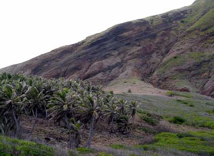
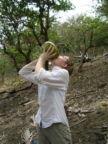
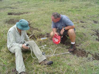
Weighed down with supplies and equipment for a 4-day excursion northwards, we (Alison, Toby and Dave) took off from Saipan with Mike at 6am on Sunday morning. Our first stop was Pagan where we met up with Erik, Maarten, Jenn and Lillie for a brief tote-a-tot before heading for the fumaroles on the south part of the island. Funnily, they didn't mention anything about wild cows (see later)! After successfully sampling the fumaroles (see Jenn's Log: April 18), we headed for Alamagan and scoria deposits on the south part of the island. Toby and Alison headed up the slopes of the cone while I scoped out refreshments for our returning heroes. Because they did so well in finding olivine-rich deposits, I rewarded them with the best coconut milk that they have ever had in their lives. We also managed to reach the summit of Alamagan to sample some weak (diffusive) fumaroles. After ferrying us around for over a week, Mike was taking an interest in the gas geochemistry of subduction zones and Toby is seen here explaining the finer points of taking temperature measurements and collecting the gases.
We returned to Pagan to spend the night camped at the airstrip blissfully unaware of any dangers associated with nocturnal bovine intruders. The first encounter was about midnight when we were all awoken by the loudest snorting sounds imaginable - the bulls must have been within 10 ft of our tents. Mike managed to scare them away with true and tried tactics - shouting and liberal use of the flashlight. We all returned to sleep only for the whole event to be repeated at about 3:45am. Toby was prepared for their return: he had his tent open and was ready to sprint off his blocks (into the ocean) if any of the bulls were to attack his tent. Alison decided to play the odds (a skill honed in Vegas while she was a graduate student). She figured that she has a 1 in 4 chance of being trampled so decided to sleep through the whole ordeal. I was ill-prepared and could only lay as still as I could not even daring to unzip the tent in case the bulls heard the sound and decided to charge. Fortunately, we didn't need to employ these various strategies as the bulls decided to leave of their own accord after they had suitably terrified the bunch of us. They were probably just having a fun night out with the guys! For me, it was certainly a night to remember.
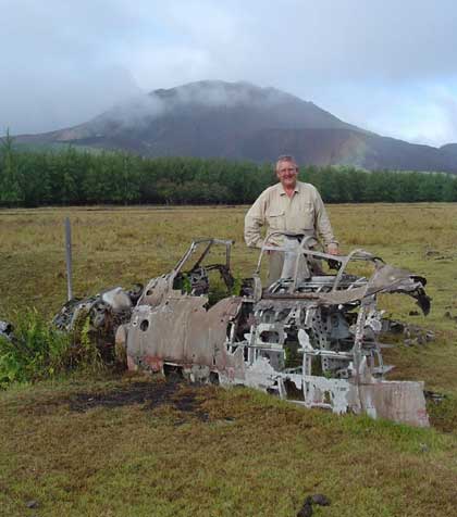
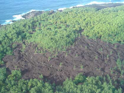
We explored the Pagan airstrip the next morning finding lots of remnants of WWII activity. Maarten showed the bomb craters on video (Log: April 19), and we saw aircraft debris, air-raid shelters and anti-aircraft guns. The next island on the itinerary is Agrigan, and as we left Pagan we had remarkable views of the volcano, cinder cones and lava flows (photo 5: lava on the north coast of Pagan).