| SCRIPPS INSTITUTION OF OCEANOGRAPHY, UCSD |
| the expedition |
|
||
| the science | |||
| tools & techniques | |||
| japanese life | |||
| daily journal | |||
| the team | |||
|
:: VOLCANOES :: Fuji Hakone Oshima Nii-Jima • Shikinejima Hachijo-Jima Aoga-Shima |
|
|||||||||||||||||||||||||||||||||||||||||||||||||||||||||||||||||||||||||||||||||||||||||||||||||||||||||

Daily Journal
Day 2 | July 19, 2005
The first Izu samples
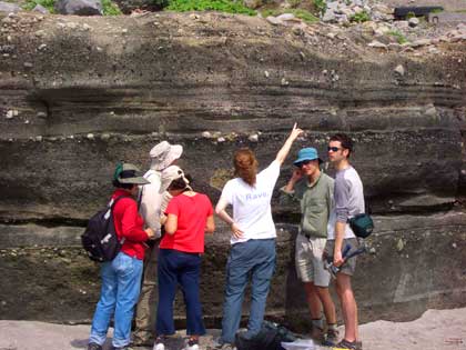
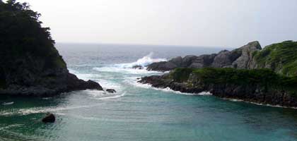
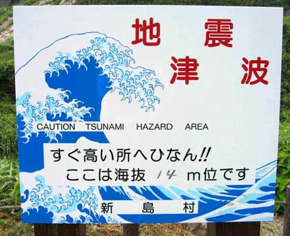
This morning we headed out early to sample rocks at Awaiura beach on the eastern shore of Niijima. The deposits on the beach showed successive layers of volcanic rocks which contain gases trapped in olivine and pyroxene minerals. It is by analyzing these minerals that we can characterize the gas chemistry of the underlying subduction zone. Warning signs found at this beach and most other beaches in Japan artistically inform visitors of the tsunami threat. An additional potential danger - at this time of year - is typhoons.

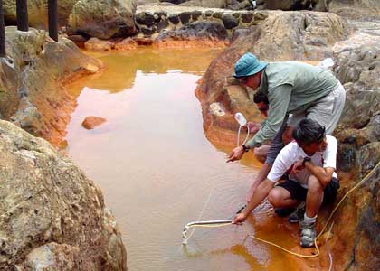
The recent typhoon that passed to the south of Japan (named Hai-tang - meaning wild apple in Chinese) made for choppy seas as we headed by ferry to the neighboring island of Shikinejima for afternoon gas sampling. This island is a popular tourist resort with lovely beaches and hot springs. Jinata hot springs are located near the ocean and the pools are stained orange due to the presence of iron oxide. We measured water temperatures up to 66°C and though our joint efforts were able to collect good gas samples at this site.